Annapurna Circuit Trek Route Map Explained
The Annapurna Circuit circumnavigates the Dhaulagiri and Annapurna mountains in north central Nepal. It’s crucial to understand where all of these pieces of landscape lie prior to walking to the trail, as being able to see and understand the what, the where and the why of what’s coming next can only illuminate each day’s journey.
The starting point of the trekking route is Besisahar, at 820 meters of altitude, located at the foothills of the Pokhara region. Then, following the Marsyangdi River, the trekking path runs to the north and west through a variety of interesting gorges and continues its elevation journey through subtropical forests, warm temperate rainforests, and eventually alpine biospheres where the Manang Valley lies. The journey runs east from Besisahar via Chame, Pisang, and Manang.
When reaching the Manang point (3,519 m), one can witness a complete change in the road configuration. At Manang, the valley opens up to a wide semi-arid plateau where it is possible to see Annapurna III, Gangapurna, and Tilicho. The final way goes to the west and north of Manang, that is, up to the Yak Kharka and Thorong Phedi villages, respectively.
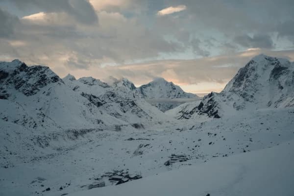
Thorong La Pass at 5,416 m is the center of the entire trek - the point where the trek enters the Kali Gandaki watershed from the Marsyangdi watershed. Everything east of Thorong La flows to the Bay of Bengal through Marsyangdi, while everything west of it flows through Kali Gandaki. When you stand under the prayer flags at the top, you are literally standing on the continental divide of the Annapurna range.
The descent from Thorong La to the pilgrimage site of Muktinath at an elevation of 3,800 m is also very popular throughout Nepal. The trip then continues from Muktinath down into the Kali Gandaki Valley, through Kagbeni, Marpha and Jomsom on its way down to Pokhara.
Important route components on the map:
- Rivers: the Marsyangdi River (uphill side) and the Kali Gandaki River (downhill side)
- Main route access: the jeep road runs parallel to the trail beginning from Besisahar to Chame, and then from Jomsom southwards - as such, both aspects will have an effect on access and experience around these parts.
- Secondary routes: the route to Tilicho Lake branches west from Manang and Khangsar; Nar Phu Valley branches north from Koto (located between Chame and Pisang); Upper Pisang route is above Lower Pisang.
- Flying access: the Jomsom Airport connects to Pokhara - the most used exit point for trekkers coming to the end of the circuit.
Looking at the route on the map the circuit goes counter-clockwise. You should trace your finger from Besisahar north along the Marsyangdi, then west over Thorong La, and finally down the Kali Gandaki and to Jomsom.
See our full Annapurna Circuit Trek Map for more detailed plans.
Complete Stage-by-Stage Annapurna Circuit Route
Each stage presented here is created with the same principle system. The walking times mentioned are actual times spent on the trail for a healthy hiker moving without stopping - they don’t include breaks for meals or photography. In reality, each day should have an extra 1–2 hours added to its duration.
Stage 1: Besisahar to Bahundanda
- Start: Besisahar (820 m) | Finish: Bahundanda (1 310 m)
- Distance covered: ~12 km | Walking hours: 4-5 hrs | Elevation gain: +490 | Difficulty level: Easy
The first day is the simplest day. The path rises from the small town of Besisahar through rice fields and small villages of Gurung, alongside the Marsyangdi River or in a westerly direction. The path is wide enough for walking - we’re not in the mountain area yet. Bahundanda is located on a ridge above the valley and is one of the first places where trekkers can see the real Himalayas. There are plenty of places to stay, and they are all well-supplied with food.
The first day is easy. Most trekkers want to continue further even though we always advise against it. Don’t hurry; let your legs rest.
Stage 2: Bahundanda to Chame
- Beginning Point: Bahundanda (1,310 meters) | End Point: Chame (2,710 meters)
- Distance Covered: ~22 kilometers | Hiking Duration: 6–7 hours | Ascended Elevation: +1,400 meters | Difficulty Level: Moderate
The entire journey comprises various lengthy portions with challenging climbs. The path winds its way through Ngadi, Jagat, Dharapani, and Bagarchhap — notable for being remarkably different from each other. The trip begins to change after Dharapani: while subtropical vegetation sorts remain, pine trees start making their appearance, and the mountains on either side begin becoming much closer to one another. Bagarchhap is the point at which we enter Manang District and witness the landscapes and lifestyle of natives becoming heavily influenced by Tibetan culture. The journey’s end, Chame, being the administrative capital of the district, has various useful amenities along the route.
The area between Jagat and Chame is the part of the journey when we feel the changes both in the scenery and climate.
Stage 3: Chame to Lower Pisang
- Start: Chame (2710m) | Finish: Lower Pisang (3200m)
- Distance: ~16km | Duration: 5-6 hours | Elevation gain: +490m | Difficulty: Moderate
Today the day begins by following the river past the astonishing rock spire, Paungda Danda - a near perpendicular rock face rising 1500m from the ground. The dense forest is reduced to a few trees, revealing the first views of the great mountains. From Swargadwari, you will be able to admire Annapurna II from an excellent vantage point, and then go downhill towards the Marsyangdi River and Lower Pisang. If the weather permits, feel free to take the upper trail towards the settlement of Upper Pisang, where the views of the Annapurnas are much more impressive.
It is hard to believe how impressive Paungda Danda is until one reaches the bottom of the cliff and looks at it going all the way up.
Each stage presented here is created with the same principle system. The walking times mentioned are actual times spent on the trail for a healthy hiker moving without stopping - they don’t include breaks for meals or photography. In reality, each day should have an extra 1–2 hours added to its duration.
Stage 4: Pisang to Manang
- Start: Lower/Upper Pisang (3,200–3,300 m) | End: Manang (3,519 m) Distance: ~18 km | Duration: 5–6 hrs | Gain: +219–319 m | Difficulty: Easy to Moderate
Today presents two route options, including travels through the lower valley or high ridge trails. The high route stands out in terms of elevation and spectacular panoramic views of Annapurna II, III and IV, as it is visible for several hours from many vantage points along the way. In both cases, the routes meet in Manang. Before reaching Manang, trekking should pass through the historic town of Braga with the 500-year-old gompa that shocks everyone by its beauty. The Ghyaru viewpoint on the high route is the first site where trekkers can enjoy a stunning view of the Annapurna mountain range with its mind-blowing size.
Stage 5: Acclimatization Day in Manang
Start/End: Manang (3,519 m) Distance: 0 km (rest) or 8–10 km (Ice Lake hike) | Walking hours: 0 or 4–5 hrs | Height gain: 0 or +1,081 m (to Ice Lake) | Toughness: Rest period/Moderate-Hard (Ice Lake)
This is an important day instead of merely a wasted one. Whenever the altitude reaches this level, your body needs some time to adapt before you move to higher altitudes. Ice Lake trek to 4,600 m gives you a chance to experience the "climb high, sleep low" principle. In most of the trekking season in the Manang region, you can participate in free altitude awareness lectures organized by the Himalayan Rescue Association. These lectures are vital for your safety on Thorong La.
Those trekkers who go directly to Yak Kharka without resting in Manang are the people we help most of the time in High Camp, as there is a direct correlation between skipping this rest and feeling very bad later.
Stage 6: Manang to Yak Kharka
- Starting Point: Manang (3,519 m) | Ending Point: Yak Kharka (4,018 m) Distance: ~8 km | Walking Duration: 3–4 hrs | Elevation Gain: +499 m | Difficulty Level: Moderate
The day is shorter yet important for acclimatization. The trail leads us from the Manang bowl to the open area of the region. Grazing yaks can be seen grazing in the mountains. Vegetation is scarce, and the wind becomes stronger. Yak Kharka is a simple place with a couple of tea houses, but one of the best heights to prepare your body for acclimatization for the high camp climb tomorrow.
This distance seems uncomplicated in theory; however, the elevation change should be accounted for. Make sure to take your time so that you can reach the final point without exhaustion.
Stage 7: Yak Kharka to Thorong High Camp
- Starting Point: Yak Kharka (4,018 m)| Destination: Thorong High Camp (4,925 m Distance: Approx. 5 km| Walking Time: 3-4 hrs| Elevation Gain: 907 m| Difficulty: Moderate to Hard
The route to High Camp is much more challenging than that of previous days, and its altitude is felt at every step. The terrain is completely barren, consisting of rock, sky and the white color of snowfields along the line of the horizon. High Camp is situated on a ridge at a height of nearly 5000 meters. The evening at this site is freezing cool even in the summer period. Be ready and pack all your belongings before sleeping in order to wake up before dawn. Most of the trekking enthusiasts leave this point between 4-5 AM.
The ascent from Yak Kharka seems steeper than it has been depicted on the map. The altitude makes every 100-meter elevation gained at this point much harder when compared to the elevation gain at 2000 meters. Thus, prepare your energy in advance.
Stage 8: Trekking from Thorong High Camp to Muktinath via Thorong La
- Start / Departure Point: Thorong High Camp (4.925 m)
- Destination: Muktinath (3.800m)
- Distance: approx. 16 km | Walking Time: 7-8 h
- Elevation Gain: +491m | Elevation Loss: -1616m | Difficulty: Hard
Today is the highest & most demanding Stretch of this adventure. Ascending from the High Camp to the pass takes 3 to 4 hours of laborious climbing in the thin air. The summit of the Thorong La at an altitude of 5,416 meters is marked by prayer flags and stone piles and, on a clear day, offers a breathtaking view of Annapurna, Dhaulagiri, Yakawa Kang, and the Mustang plateau.
The descent from Thorong La to Muktinath consists of going down 1,600 m through a steep rocky path which is hard on the knees but, at the same time, allows one to reach the lower levels and feel warmer air.
The 200 m before the top is the hardest part of the trek. Not that it is the part of the way requiring climbing skills, but rather because of the altitude, making it really tough.
Stage 9: Muktinath to Jomsom
- Start: Muktinath (3,800 m) | End: Jomsom (2,720 m)
- Distance: ~22 km | Walking hours: 5 to 6 hrs or 1.5 hrs by jeep | Elevation loss: -1,080 m | Difficulty: Easy to Moderate
The path leads us southwards, following the river Kali Gandaki. The very winds that blow in this canyon are famous and can reach a higher level this afternoon. Therefore, you are suggested to leave Muktinath early in the morning. There are three important settlements on the way: Kagbeni (the fortress village found at the entrance of Upper Mustang), Tukuche, and Marpha (the place known for its apple brandy). The biggest town in Upper Mustang, Jomsom, has an airport and all the necessary amenities.
You have probably heard about the winds of Kali Gandaki. People traveling to Jomsom after 9 AM experience the wind resistance that tires them more than any other factor.
Stage 10: Jomsom to Tatopani (Optional Extension)
- Start: Jomsom (2,720 m) | End: Tatopani (1,190 m)
- Distance: ~20 km | Walking duration: 6 - 7 hrs | Elevation gain: -1,530 m | Degree of difficulty: Moderate
Several hikers usually leave Jomsom by air or land. Hikers continue in trek and walk through Ghasa and Dana to Tatopani, which is known for naturally available hot springs that people usually visit. The trek in the lower part of the Kali- Gandaki - is marked by high temperatures and the reappearance of rhododendrons that survived in the area. Tatopani springs are a very good reward for the trek through Thorong-la.
Tatopani is far away from the previous High Camp made only 5 days ago. It is warm there, with plenty of palm trees all around, as well as singing birds.
Stage 11: Tatopani to Ghorepani (Optional Segment)
- Start Point: Tatopani (1,190 m) | Final Point: Ghorepani (2,874 m)
- Distance: ~14 km | Walking hours: 5–6 hrs | Elevation increase: +1,684 m | Difficulty level: Hard
A tough climb back up to the rhododendron area. In exchange, you will find Ghorepani, a perfect spot to visit Poon Hill, where you can see a beautifully unique sunrise in the Himalayas. The steepness of the climb is challenging, but the rhododendron forest makes the hike beautiful, especially in springtime.
When it comes to this hike, Tatopani-to-Ghorepani can easily be evaluated as hard after 10+ days of trekking. Thorong La hikers won't forget this uphill. You need to be patient.
Stage 12: Ghorepani to Nayapul / Pokhara (Optional Extension)
- Starting Point : Ghorepani (2,874m) | Ending point : Nayapul(1,070m)/ Pokhara | Distance covered :~13 km to nayapul | Walking Hours: 4-5 hrs | Elevation Loss:-1,804m | Difficulty: Moderate.
Early in the morning before Sunrise Go for the Poon Hill Trek (3,210m) for enjoying the mesmerizing view of the sunrise over the height of the Annapurna & Dhaulagiri.
After that, descend from Poon Hill passing by the Ulleri & Tikhedhunga Villages, then proceed towards Nayapul where you can get the transport facilities available there to reach Pokhara. So this would be your last day of the trek, which ends up perfectly and successfully.
Each village on the Annapurna Circuit fulfills a particular need, whether logistical or cultural (or both). Learn why each stop is key and what to anticipate upon arrival.
Major Villages and Landmarks Along the Route
Each village on the Annapurna Circuit fulfills a particular need, whether logistical or cultural (or both). Learn why each stop is key and what to anticipate upon arrival.
| Village |
Altitude |
Why It Matters
|
Accommodation |
|
Besisahar
|
820 m
|
Circuit gateway; last major ATM; permit checkpoint; jeep hub
|
Good — multiple teahouses and hotels
|
| Bahundanda |
1,310 m
|
First ridge viewpoint; cultural transition into Gurung territory
|
Basic teahouses
|
| Jagat |
1,300 m
|
Last checkpoint before Manang District; trail narrows here
|
Basic teahouses
|
|
Dharapani
|
1,920 m
|
Junction for Nar Phu Valley detour; landscape shifts dramatically
|
Moderate teahouses
|
|
Bagarchhap
|
2,160 m
|
First Tibetan-style village; pine forests begin; cultural shift
|
Basic to moderate
|
| Chame |
2,710 m
|
District HQ of Manang; best facilities east of Manang; bakery
|
Good — multiple options
|
|
Upper Pisang
|
3,300 m
|
Best early Annapurna range views; traditional Manangi village
|
Basic teahouses
|
|
Braga
|
3,475 m
|
500-year-old gompa on cliffside; most historic village on circuit
|
Basic teahouses
|
| Manang |
3,519 m
|
Last large village before high altitude; HRA lecture; medical post; best Wi-Fi
|
Good — multiple teahouses
|
|
Tilicho Base Camp
|
4,150 m
|
Staging point for Tilicho Lake detour
|
Basic — 3–4 teahouses
|
|
Yak Kharka
|
4,018 m
|
Important acclimatization stop before High Camp
|
Basic teahouses
|
|
Thorong Phedi
|
4,450 m
|
Base of Thorong La ascent; early morning start point
|
Basic — crowded in peak season
|
|
Thorong High Camp
|
4,925 m
|
Final stop before Thorong La; pre-dawn departure point
|
Very basic — simple dorms
|
|
Thorong La Pass
|
5,416 m
|
Highest point of circuit; watershed crossing; prayer flag summit
|
No accommodation
|
| Muktinath |
3,800 m
|
Sacred Hindu and Buddhist pilgrimage site; temple complex; first proper facilities after pass
|
Good — multiple teahouses
|
|
Kagbeni
|
2,810 m
|
Gateway to Upper Mustang; fortress village; dramatic setting
|
Moderate teahouses
|
| Marpha |
2,670 m
|
Famous for apple brandy and orchards; charming stone-paved streets
|
Good teahouses
|
| Jomsom |
2,720 m
|
Mustang district HQ; airport; best facilities since Manang; circuit exit point
|
Good — hotels and teahouses
|
| Tatopani |
1,190 m
|
Hot spring pools; subtropical return; popular rest stop
|
Good teahouses
|
| Ghorepani |
2,874 m
|
Gateway to Poon Hill sunrise; rhododendron forest; famous viewpoint
|
Good teahouses |
For thorough information on acclimatization in Manang, refer to our Manang Acclimatization Guide.
Route Distance, Elevation & Walking Time
Knowing the statistics ahead of your trip prepares you for a better-paced experience while avoiding pitfalls, such as overexertion or not accounting for the effects of altitude on your walking speed.
Please note that distance measurements using GPS may vary by 10-20% from those indicated here due to factors such as the type of device being used, the route profile (and if jeep shortcuts were taken). The distance values already provided above are for standard trails and omit any shortcuts.
| Stage |
Route |
Distance |
Walk Time
|
Elevation Gain/Loss
|
Difficulty |
| 1 |
Besisahar → Bahundanda
|
12 km
|
4–5 hrs
|
+490 m
|
Easy |
| 2 |
Bahundanda → Chame
|
22 km
|
6–7 hrs
|
+1,400 m
|
Moderate |
| 3 |
Chame → Pisang
|
16 km
|
5–6 hrs
|
+490 m
|
Moderate |
| 4 |
Pisang → Manang
|
18 km
|
5–6 hrs
|
+219 m
|
Easy–Moderate
|
| 5 |
Manang (rest day / Ice Lake)
|
0–10 km
|
0–5 hrs
|
0 / +1,081 m
|
Rest / Hard
|
| 6 |
Manang → Yak Kharka
|
8 km
|
3–4 hrs
|
+499 m
|
Moderate |
| 7 |
Yak Kharka → High Camp
|
5 km
|
3–4 hrs
|
+907 m
|
Moderate–Hard
|
| 8 |
High Camp → Muktinath
|
16 km
|
7–8 hrs
|
+491 m / -1,616 m
|
Hard |
| 9 |
Muktinath → Jomsom
|
22 km
|
5–6 hrs
|
-1,080 m
|
Easy–Moderate
|
| 10 |
Jomsom → Tatopani (optional)
|
20 km
|
6–7 hrs
|
-1,530 m
|
Moderate |
| 11 |
Tatopani → Ghorepani (optional)
|
14 km
|
5–6 hrs
|
+1,684 m
|
Hard |
| 12 |
Ghorepani → Nayapul (optional)
|
13 km
|
4–5 hrs
|
-1,804 m
|
Moderate |
|
TOTAL (core route)
|
Besisahar → Jomsom
|
~119 km
|
~42–48 hrs
|
|
|
| TOTAL (full extension) |
Besisahar → Nayapul |
~166 km
|
~58–68 hrs
|
|
|
- Why altitude matters more than distance: a 5 km stage at 4,500 meters takes longer and is more grueling than a 15 km stage at 1,500 meters. Above 4,000 m, the body operates at about 60-70% of sea-level efficiency, independent of the level of training. It is recommended to plan daily objectives around altitude, not just kilometers.
- Highest day: Most significant day: Stage 8 - Thorong High Camp to Muktinath via Thorong La (5,416 m)
- Longest distance stages: Stage 2 - Bahundanda to Chame (22 km) and Stage 9 - Muktinath to Jomsom (22 km)
- Most physically demanding stage: Stage 8 - combination of the highest altitude and steep climb followed by 1,600 m descent.
To know the details of stage comparison, see our Annapurna Circuit Distance article.
Transportation Before, During & After the Route
In order to make your trip to and from Annapurna Circuit, there are a lot of transportation option available from low budget, high cost, uncomfortable to the extremely comfortable. Depending on your budget and other factors of importance, you have choices like:
Route Flow:
Kathmandu
↓
Besisahar (bus 7–8 hrs / private jeep 6–7 hrs)
↓
Chame (shared jeep 3–4 hrs from Besisahar — standard for most trekkers)
↓
Walk the full circuit (Chame → Manang → Thorong La → Muktinath → Jomsom)
↓
Jomsom (flight to Pokhara 25 min / jeep 8–9 hrs)
↓
Pokhara (flight to Kathmandu 25 min / bus 7–8 hrs)
Kathmandu to Besisahar
Some of the ways to reach Besisahar are by Tourist bus ($8-$12 and 7-8 hours ride) or by private jeep or car ($80-$130 and 6-7 hours ride). From Kathmandu the point of departure will be either Thamel or Macchapokhari bus park.
Besisahar to Chame (Jeep)
The ways to reach Chame include shared ($10-$15 per person and 3-4 hours of travel) and private jeeps ($50-$80). There is no way of traveling by vehicle on the main trekking route between Chame and Muktinath. However, it is possible to take a jeep ride on the route between Muktinath and Jomsom so as to avoid walking.
Jomsom to Pokhara
Flights with Yeti Airlines or Tara Air will take travelers from Jomsom to Pokhara ($120-$160 and 25 minutes flight time).
Also it is possible to take the jeep trip from Jomsom to Pokhara which costs $30-$50.
Pokhara to Kathmandu
Travelers can choose between flight ($80-$120 and 25 minutes flight time), tourist bus ($10-$15 and 7-8 hours travel time) or private vehicle ($150-$200).
Seasonal Conditions on the Road: The Besisahar-Chame road is affected by landslides during the rainy months (June to August) and is also subject to damage due to torrential rainfall in the early fall season. In case you are planning to travel in September, check the current road conditions with your agency beforehand. The Jomsom-Pokhara road is also treacherous throughout the year, and most hikers prefer to fly.
If you need complete transportation information, refer our Kathmandu to Besisahar Guide.
Alternative Routes, Side Trips & Route Variations
The standard counterclockwise Annapurna Circuit path is the main one; however, there are several alternative variations that can enhance the traveling experience of trekkers with sufficient time or particular interests.
Excursion to Tilicho Lake
- Route: From the distance between Manang and Khangsar
- Duration: Plus two days
- Height: 4919 m
- Recommendations: For all travelers who complete the Annapurna Circle trail which takes at least 14 days.
Tilicho Lake is one of the most elevated lakes across the world and an actual highlight that many trekkers consider more unforgettable than the Thorong La pass itself. The trail diverges from its main route near Manang and ascends along with the increasingly breathtaking scenery towards Tilicho base camp first then to the lake. The views in the morning when the lake appears - dark blue, still, with snow covering and dry rocks in the surrounding area are astonishing. This adds significant height and 2 days but brings experiences that the main trek can hardly offer.
More details can be found in our guide Tilicho Lake Trek.
Ice Lake Acclimatization Hike
- From: Manang
- Duration: Half day (4-5 hours round trip)
- Altitude: 4600 m
- Suitable for: All trekkers on their rest day in Manang
This hike is the perfect "climb high - sleep low" acclimatization activity that can be done on the rest day in Manang. The lake itself is located in a bare, lifeless bowl above the valley with the breathtaking views of Annapurna III and Gangapurna.
Detour to Nar Phu Valley
- Departure Point: Koto (between Bagarchhap and Chame)
- Length of Stay: More 4-7 days
- Maximum Elevation: 5,100 m (Kang La Pass)
- Who Should Go: Experienced trekkers in search of remote places to explore
Nar and Phu are hidden away in a remote valley in Nepal and are likely to require a government permit (costing around $90-100 per week). The valley has the terrain of a Tibetan plateau and has a very different landscape from the circuit area. Most trekkers do not usually enjoy this detour, which is an advantage owing to its remoteness. The trek involves a crossing of Kang La Pass that is located at the elevation of 5,100 meters.
The High Route of Upper Pisang
- Departure Point: Pisang
- Length of Stay: More 1-2 hours
- Maximum Elevation: ~3,500 m
- Who Should Go: All trekkers
The upper Pisang high route via Ghyaru and Ngawal features great mountain views that are better than the views obtained via the lower valley route and also involves passing through authentic Manangi villages. The route is well-established and is easy and uncomplicated. Always take the high route between Pisang and Manang unless there is snow or ice present on the high route.
Ghorepani Extension (Poon Hill)
- Means of approach to this area: either from Nayapul or from Tatopani
- Duration of the trek: The trip lasts extra 2 to 3 days after reaching Jomsom (if continuing the hike)
- Height: Poon Hill 3210 meters
- Who will benefit from it: Photographers, travelers who came to Nepal for the first time, trekkers who want to see the classic view of the sunrise over Annapurna
Poon Hill is the most photographed sunrise viewpoint in Nepal. The view of the Annapurna and Dhaulagiri ranges from 3210 meters provides a panorama that is more present in Instagram accounts than any other Himalayan view. In addition to Ghorepani and Poon Hill, the loop of the trekking trip will last one more week since trekkers will go through the beautiful rhododendron forests and will have the opportunity to witness the rich culture.
Short Annapurna Circuit (Chame Start)
- Duration: Saves 2 days from the full circuit
- Best for: Trekkers with limited time; experienced hikers wanting the high-altitude section only
Using a jeep for the Chame start instead of walking from Besisahar allows the adventurer to save two days but will still get all of the necessary high-altitude experiences of the circuit. The Besisahar-Chame section of trail follows the road and crosses through less exciting landscape than the remainder of the circuit.
Route Challenges, Safety & Navigation Tips
The Annapurna Circuit is one of the best-marked trekking routes in Nepal but still poses serious navigation and safety issues. Here is a practical solution-by-problem guide compiled from our guides' actual encounters while trekking in the mountains.
Navigation - the Problem with Marking the Trails
- The Problem: Trail signs often differ in quality, and, due to conditions, the signs may either be damaged or missing altogether.
- The Solution: It is recommended to download offline maps while in Kathmandu. Both Maps.me and Gaia GPS have maps of the Annapurna Circuit. It is also advisable to have a backup GPS track on the phone. Above 4,500 m, follow other trekkers’ footprints in the snow.
Thorong La - Weather Problem
- The Problem: The pass is most dangerous in the afternoon when winds and clouds pick up. Not adhering to this can result in crossing in the wrong conditions.
- The Solution: The best time to leave Thorong High Camp is from 4 a.m. to 5 a.m. It is advisable to reach the top by 9 a.m. If for whatever reason, the summit cannot be reached by 11 a.m., one should descend.
River Crossings
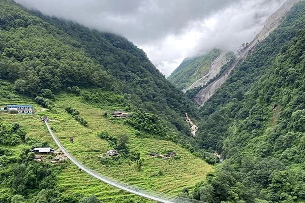
- Problem: After heavy rains or landslides, some suspension bridges on the route may be damaged or closed.
- Solution: At the last teahouse, ask about the bridge situation on your way - your guide will know thanks to the morning communication with other groups. Do not take the risk of crossing rivers without assurance from locals, as during the day river levels can change significantly.
Landslide Zones
- Problem: Landslides are common on the section from Dharapani to Chame and on several sections of the lower gorge.
- Solution: Move swiftly through open uphill stretches, avoid resting in places located under slopes filled with new debris. Always check the condition of the route with your travel agency before you set off, especially at the beginning of September when the monsoon has just finished.
Snow on the Trail
- Problem: Snow on Thorong La and the trail before it can cause icy, unmarked sections where people can get lost.
- Solution: Micro spikes or crampons will allow for your hiking early spring (March) and late in the fall (November). Your guide will help you attain the peak depending on the situation. If you do not have such gear and the trail above High Camp is icy, wait for the sun to soften the ice or follow your guide's recommendation. Never attempt to cross the pass alone in dangerous snow conditions.
Altitude Sickness
- Problem: AMS occurs above, 3,500 m and is the gravest risk involved with the trekking.
- Solution: Stick to the ascending timetable always moving no more than 300-500 m above the level of 3,000 m per day. Ensure to get the acclimatization day in Manang. Make use of the pulse oximeter and measure the oxygen concentration daily during your trek above 3,500 m. In case, if SPO2 is lower than 85% or symptoms of AMS appear, do not ascend further and turn back.
Emergency Exits
- From Manang: Trekkers can go in reverse I.e. travel back to Chame and Besisahar taking approximately 2-3 days.
- From Yak Kharka / Thorong Phedi: Return trip to Manang (minimum half a day).
- From Muktinath: Jeep drive to Jomsom (1.5 hrs) and then helicopter flight from Jomsom to Pokhara.
- From Jomsom: Airport or the highway expediting trip to Pokhara.
- Helicopter evacuation is available and it is important to ensure your insurance extends to the elevation of 6,000 m.
Offline Maps
- Maps.me can be used to find out the route offline and is completely free.
- Gaia GPS is paid and gives more detailed information.
- AllTrails have some routes but not all.
This information will help you decide your way of trekking when choosing what route of the Annapurna Circuit to take, as not all trekkers want to take the same trek. Their trip may differ in terms of walking time, fitness level and preference.
If you are planning on fully safeguarding yourself, take a look at our Annapurna Trek safety guide here.
Choosing the Best Route for Your Trekking Style
Not everyone plans the same trekking trip while doing the Annapurna Circuit. It is flexible in terms of meeting various travelers’ objectives, provided that the option chosen is suitable for one’s physical capability, timing, and purposes.
Beginners
- Best route: Standard circuit, Chame start, 14-days -16 days including acclimatization days.
- Why: Starting from Chame bypasses 2 days of road-walking but still includes all the best high-altitude sights. 16 days allow for relaxed daily walking and comprehensive acclimatization. It’s probably best to skip the addition of Tilicho Lake on a first high-altitude trek, it increases the challenge, and you are better placed to manage it on subsequent trips.
- Avoid: Overly rushed 12-day treks, Nar Phu extension, and winter treks.
Families with children
- Best route: Besisahar to Manang only (don't cross Thorong La)- travel back down the same way or take a jeep.
- Why: The lower part of the circuit up to Manang travels through fantastic scenery, and you won’t spend too much time over 3,500 m, so it is appropriate for children. Young children shouldn’t be taken over Thorong La without prior high-altitude experience. The scenery in Manang Valley and from Upper Pisang is spectacular enough to satisfy children.
- Avoid: High Camp; attempting Thorong La pass and visiting Tilicho Lake with young children.
Experienced trekkers
- Recommended route: Full circuit including Tilicho Lake, Nar Phu Valley, and Ghorepani extension.
- Why: Trekking veterans will appreciate the remote beauty of Nar Phu, which is unknown to most who completed the Annapurna Circuit. The addition of Tilicho and Poon Hill means you will gain a more complete experience of the area.
- Avoid: Experienced trekkers won't be held back by anything on the standard route.
Photographers
- Recommended route: Full circuit including Ghorepani extension for Poon Hill; Upper Pisang high route essential; departure in spring for blossoming of rhododendrons.
- Why: Different shades of spring flowers, views at Ghyaru on high Pisang route, light in Kali Gandaki valley, and sunrise at Poon Hill will give you the most diverse photographic experience in Nepal.
- Avoid: The rainy season and rushing through the stages too close to dawn.
Older trekkers (60+)
- Best route: 16-18 day itinerary with extra rest days; start in Chame to lessen initial demands.
- Why: More days give the body time to adapt at each altitude; shorter distances will reduce its tiredness. Actual core trek - Chame to Jomsom via Thorong La can be executed regardless of age, if the pace is right.
- Avoid: 12-day trekkings; winter tours; high-altitude excursions without acclimatization.
Solo trekkers
- Best route: Regular circuit with a hired local guide; all paths available.
- Why: Annapurna Circuit is one of the safest and most well-planned solo trekking routes with enough teahouses and permits along the way. Solo trekkers will need to know offline map navigation and have appropriate equipment.
- Avoid: Hiking the Nar Phu Valley solo ( restricted area; needs special permit, knowledge of locals)
Luxury trekkers
- Best Route: Exclusive guided journey with improved teahouses; flight to and from Jomsom; private automobile transportation.
- Why: Although the Annapurna Circuit doesn’t have exclusive luxury accommodation options, the use of private guides, the possibility to rent single rooms, and the employment of the best teahouses along with personalized transportation to/from Jomsom offer a more comfortable experience than a trek with a group.
If you want a more general idea about timing in relation to your specific itinerary, please take a look at our Best Time to Annapurna Circuit Trek guide.
Frequently Asked Questions About the Annapurna Circuit Route
Where does the Annapurna Circuit start?
The conventional starting point is Besisahar at 820 m, which is accessible by bus or jeep from Kathmandu (7-8 hours). Most trekkers go on to take a shared jeep from Besisahar to Chame (2,710 m) to save two days’ walking. Journeying on foot from Besisahar gives an authentic experience of the classic circuit but adds about an extra two days to the trek.
Where does the Annapurna Circuit end?
Most trekkers finish in Jomsom (2,720 m) but fly or take a jeep from there to Pokhara. Trekkers preferring journeying further to Ghorepani or Poon Hill finish in Nayapul (1,070 m) from where they take a short drive to Pokhara. The exact ending point depends on the whereabouts you choose to trek and how much time you have.
Is the route well marked?
Yes, in general, from Besisahar to Jomsom. Signs, marking stones, and cairns tell trekkers about junctions. However, as trekkers approach the Thorong La area above 4,500 m the signs become less noticeable especially after snow. Therefore, it’s advisable to have an offline map at all times. The other way to Tilicho Lake is not marked so well and requires a local guide.
Can beginners follow the trail without a guide?
Beginner trekkers can complete the main circuit and return home happily on their own with good preparation and offline maps. However, on certain parts of the other itinerary like Tilicho Lake, the Nar Phu extension, and Thorong La in challenging weather, local knowledge proves to be useful and offers much better safety, as well as better decisions. We suggest, at least while going to the conclusion of the route, to hire a guide when doing the Thorong La section for the first time.
Which day is the hardest?
Stage 8 is the toughest day, and it is certainly true. It features the highest point on the path - 5,416 m, an ascent that starts early in the morning, and a descent of 1,600 m during one day, which means that the trekkers will be hiking for 7-8 hours. Among other things, it is the ascent and the altitude that makes the stage not only long but extremely tiring and difficult.
Is Thorong La dangerous?
Thorong La is not technical, but it is serious - there’s no requirement to climb or use ropes. The danger is created by altitude, weather and lack of preparation. Trekkers that leave High Camp too late, try to cross despite having AMS symptoms or lack proper cold weather gear create dangerous conditions. As long as proper preparations are made, thousands of trekkers cross Thorong La every year without a problem.
Can I skip parts of the route?
Yes. There are several parts of the trek that can be bypassed using a jeep: Besisahar to Chame — the most commonly used shortcut; Muktinath to Jomsom - 1.5 hours by jeep; and also the lower part of the route in Kali Gandaki valley. Skipping parts of the trek using a jeep will decrease total time spent walking, but will also lessen the experience gained.
How accurate are online maps?
In terms of online maps: Before embarking on your trek, it’s important to understand how trustful online maps are. Most of the online maps, Google Maps and Apple Maps included, are inaccurate when it comes to the Annapurna circuit, as they refer to roads instead of foot paths. Maps.me and Gaia GPS map application offer much more up-to-date trail mapping services; even though there might be some mistakes in high-altitude long hikes.
Which offline map is best?
Offline maps: We suggest using Maps.me as the most practical offline option out there since it’s free, simple to use and provide information on the hiking trails on the Annapurna circuit. However, Gaia GPS application is more advanced and offers topographic maps.
How many villages are on the route?
The main trekking circuit has around 30-35 important settlements on the way, depending on the trail. There are both large towns such as Jomosom and Manang and tiny mountain villages, which only have one teahouse available.
Is the route crowded?
The number of trekkers who obtain permits to access the Annapurna Circuit has remained constant in the range of 100,000–130,000 for the past few years. The busiest part of the trail is between the towns of Manang and Muktinath (the route through Thorong La); the season peaks at Jomsom in October. Overall, the lower parts of the circuit, such as Besisahar or Chame, and the optional itinerary extensions to Tatopani and Ghorepani, are less frequented. If you want to trek in solitude, the Nar Phu Valley option provides you with the most isolated experience the Annapurna area has to offer.
Can I trek it without a guide?
For the period being, Nepal does not have a mandatory rule for hiring a guide when trekking the Annapurna Circuit for most nationalities. The main route is easy to navigate using offline GPS maps and some trekking experience. Although our company recommends hiring a guide for Tilicho Lake detour, crossing Thorong La in bad weather, and going through the Nar Phu restricted area, where a guide is needed to obtain the necessary permit for the trek.
Which route is most scenic?
The stretch from Upper Pisang to Manang along the high route provides the best uninterrupted mountain scenery in the circuit with uninterrupted views of Annapurna II, III, and IV for over 5 hours. The highest point at Thorong La gives the most beautiful view in total. The valley of Kali Gandaki in the section from Jomsom to Muktinath has the most interesting geography. Poon Hill shows its position at dawn.
How long is the full circuit?
The total trek from Besisahar to Nayapul is around 160-230 km with differences in the routes taken into account. The way from Chame to Jomsom excluding the last stages is around 120 km. The trek may last either 12 or 21 days depending on the speed of walking and the conditions of climbing.
Can I combine the route with Tilicho Lake?
Yes. Tilicho Lake is the most famous place added to the classical circuit route and can be found right after Manang and before getting Yak Kharka. The detour takes around 2 additional days and goes up to 4919 m before descending back and continuing along the standard route through Shree Kharka.