Introduction to Renjo La Pass
Anyone who has ever looked at a map of the Everest region and followed the bold high ridgelines connecting the large valleys will know exactly what I'm talking about Renjo La Pass stands proudly on the landscape - bold, high and slightly unruly.
Renjo La Pass is the first of three well-known, high-altitude passes in the Khumbu region, along with Cho La Pass and Kongma La Pass. The three passes combine to create what trekkers call the "Everest Three Passes Trek", which is regarded as one of the most strenuous but most rewarding long-distance treks in Nepal.
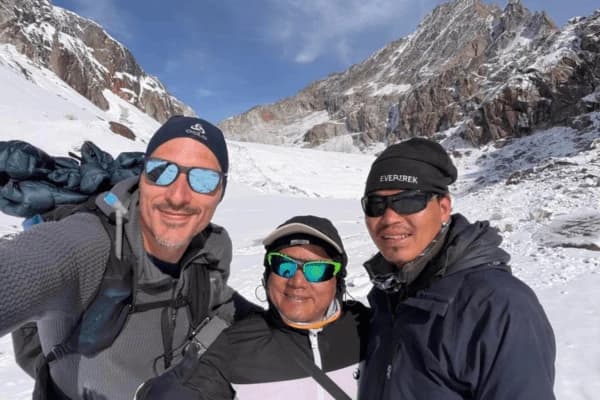
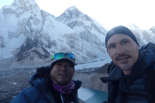
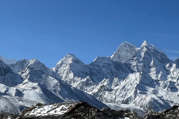
The pass itself connects Gokyo Valley on the western side to Thame Valley on the northern side and, at the summit, allows trekkers to gaze out over the giants Everest, Lhotse, Makalu, Cho Oyu, and the entire Gokyo Lakes chain simultaneously. Our team has encountered numerous high passes throughout the Himalayas, but the panorama witnessed on top of Renjo La is incredibly special.
However, it's not simply a visual spectacle. Renjo La Pass serves a specific and important function on the trail, connecting two valleys without the trekker having to return all the way back down into lower ground and then reascend. The result of this connection is that it's a crucial junction in any trekking itinerary that comprises the entire Three Passes.
So why does this need to be noted for you as a trek planner? Because you simply have no option regarding Renjo La on the Three Passes trek, you cannot avoid it once you set out on it. It's a necessary traverse with serious considerations regarding both altitude and terrain. You need to know what the pass is to be able to evaluate if you can make the trek.
If this route is something you're only beginning to explore, take a look at our Gokyo Valley Trekking Guide if you need an in-depth account of what's lying on the western side of this pass.
Renjo La Pass Elevation Explained
It is time to talk about numbers, because altitude in the Himalayas is not a thing one estimates. Renjo La Pass is at about 5,360 meters (17,585 ft). In relation, this is about the same altitude as the base camps of several of the prominent Himalayan peaks. Air at this altitude is only about half as oxygenated as at sea level. This translates into your lungs having to work twice as hard at something they take for granted at home.
So Renjo La stands relative to the two other Everest high passes:
| Pass |
Elevation (meters) |
Elevation (feet) |
| Renjo La Pass |
~5,360 m |
~17,585 ft |
| Cho La Pass |
~5,420 m |
~17,782 ft |
| Kongma La Pass |
~5,535 m |
~18,159 ft |
Renjo La is indeed at the lowest elevation of the three, but it is still not an easy place to be. At 5,360 metres, there is much less oxygen than at lower elevations; your body has to work harder to breathe, the heart has to pump faster, and your muscles are unable to perform as well due to the exertion you put them through during the trek.
Many trekkers report a huge difference in how heavy and slow their legs feel, even after trekking for some distance at a flat level before reaching Renjo La, compared to when they were at lower elevations.
The actual summit of Renjo La is little more than a very narrow ridge; you will not be able to spend very long there before the wind starts to pick up and/or the temperature drops significantly after the middle of the day, and the trail drops off on the opposite side very steeply. Therefore, the summit serves as both an accomplishment and a milestone to cross. Take pictures of yourself on the summit, and continue trekking.
To truly see how different altitudes will affect your body as you traverse the entirety of your trek, please read our Everest altitude guide prior to finalizing your journey itinerary.
Difficulty Level of Renjo La Pass
Our team considers Renjo La a moderate-to-high level of challenge, and we’re trying to be clear about our expectations for the trail.
- Difficulty is not a single thing about the trail: it is a number of challenges that occur as you’re travelling through the different stages of your journey.
- Steep ascent and descent: The base of Gokyo and the ascent to Renjo La strictly gain approximately 700 -800 metres in elevation. Near the top of the pass, the trail becomes a steep rocky section where you will frequently need to break out your "hands" and "feet", and it will get half or fully covered in snow. When you arrive at the base of Thame after your descent from Renjo La, it will feel like a similar amount of pressure is being put on your knees and balance (up to the summit, you will have gained elevation).
- Snow and ice: Even during spring and autumn, you will encounter snow in the upper section of the pass. As a consequence of the presence of ice and/or snow on the rocks and trail, what is typically a hard climb up the pass during the winter will become increasingly so as you continue to climb for hours on end. On the day of your journey, your guide will assess the conditions in the morning and advise if microspikes/crampons are necessary for the ascent/descent.
- The altitude slows everything: The "altitude" obviously affects your ability to perform. At 5,360 meters, every step you take will use up more energy than you might typically be able to use. You will take more breaks, you will breathe more often, and you will also be spending more time in the heads of those around you performing physical activity. All of these things are normal when dealing with altitude; however, you are still going to have to deal with the time needs of all these things on a long day.
- Long crossing day: Time needed for a complete trek across Gokyo to Thame is 7 or 8 hiking hours. Therefore, when making this trek, please make sure you are prepared for an all-day hike (not a half-day hike).
It's highly recommended that if you have not previously hiked over 4500 m in elevation, you should adapt to the higher altitude prior to attempting this hiking pass. See our guide on Everest trekking difficulty levels to see the levels of difficulty associated with trekking in the Everest region.
Trail Route Breakdown (Gokyo to Thame)
Here follows a description of the route with altitude for each marker:
- Gokyo (4,790 m) - Start before sunrise: Most individuals will begin their trek from Gokyo around 5-6 a.m. This early start time is ideal due to stable weather, excellent visibility, and ample time to reach the Summit prior to the winds beginning to increase in the afternoon.
- Lower Moraine trail (4,790 m → ~5,000 m): The next section will run along the edge of Ngozumpa Glacier, which is the longest glacier in Nepal. The trail is mostly level and follows the edge of a glacier through rocky terrain and provides stunning views of both Cho Oyu and the collection of lakes below. Enjoy this section of the trail because the next section will be much more difficult.
- Upper ascent to the summit (5,000 m → 5,360 m): This is where it gets serious; from this point to the Summit, the trail climbs reasonably steeply through a range of loose rocks, and the rocks will become snow as you approach the peak. Trekking poles will assist you with these last 200 meters of trail; they are short yet demanding at altitude.
- Renjo La Summit (5,360 m): On a clear day at the Renjo La Summit (5,360 m), you will see all four mountains: Mt Everest, Mt Lhotse, Mt Makalu, and the Gokyo Lake Chain. The prayer flags and cairn will show you that you are there. Take 15 to 20 minutes at this location, and then begin your descent.
- Descent to Lungden (~4,380 m): The trail descends steeply down to the Lumding Valley, which is rocky and can be slippery at times. Most trekkers take 2 - 3 hours to reach Lungden from the Summit.
- Final walk to Thame (3,820 m): After descending to Lungden, you can take an easier trail to Thame through the valley. Thame is a quiet Sherpa village that has a good selection of teahouses and a very old gompa. Total time to travel cross-country is typically between 7 and 9 hours.
Before planning your trip to your final resting point, check out our Gokyo Ri and Gokyo Valley trek guide.
Weather Conditions at Renjo La Pass
Weather conditions at 5,360 meters are much different from conditions in the valley. It can be extremely unpredictable, and sudden temperature shifts are common.
Wind at the Summit
The summit ridge at Renjo La Pass is very exposed on both sides, so winds at the ridge are coming from every direction. While mornings can often be calm, enabling an early ridge crossing, this only typically lasts until around 10-11 o'clock, when you can expect strong gusts to begin affecting you, creating a biting, frigid cold along the very exposed ridge; one reason why our guiding team requires such an early start.
Temperature Drop as You Climb
During even the most perfect day in spring, the temperature on the summit will often be at -5°C to -10°C (23°F to 14°F). Factoring in the wind chill at that altitude on the exposed summit, it will be quite freezing cold, so on a winter trek, you can expect the temperature at the summit to be in the low 20 °C, if not more. This temperature makes the trek impossible to accomplish safely without a professional guide and polar-grade clothing.
Seasonal Comparison
| Season |
Conditions |
Recommendation |
| Spring (Mar - May) |
Good visibility, some snow on pass, stable mornings |
Best time |
| Autumn (Sep - Nov) |
Clear skies, cold nights, less snow than spring |
Best time |
| Winter (Dec - Feb) |
Heavy snow, icy trail, extreme cold |
Not recommended for most |
| Monsoon (Jun - Aug) |
Low visibility, wet rocks, trail hazards |
Avoid |
Visibility Matters More Than You Think
Bad visibility at the pass not only slows things down, but it is also a danger. The trail isn't clear around the summit, and it's too easy to lose it without good visibility. We always look at the forecast the night before, and can adjust start times for optimal chances of being able to see at the pass. Clouds rolling in quickly mean that we will head out earlier.
There is a more in-depth month-by-month breakdown of the best time to trek Everest in our Everest Trekking Season Guide.
Fitness Requirement and Preparation
You do not have to be a super-athlete to cross Renjo La. You simply have to be really fit, as this pass has a way of bringing any physical shortcomings very quickly into sharp focus.
The Honest Baseline
A fitness base for Renjo La consists of being capable of trekking for 6-8 hours with a daypack, on uneven terrain, for several days in a row. If a long weekend trek at home has you recuperating for 3 days straight, it is your body's way of warning you.
Cardio Is the Foundation
Your cardiovascular system will be the workhorse at the pass (which is at 5,360 m). Your lungs will be working harder to supply the thinner air with oxygen, while your heart will be pounding to keep muscles supplied with what they need. A good cardio base will translate directly to your success on your trek. We suggest beginning your cardio work at least 8-12 weeks prior to your trip.
Practical Training Ideas
- Running or power walking for 45-60 minutes four to five times per week
- Climbing stairs-arguably one of the best exercises that mimics uphill climbing but incorporates extra elevation gain.
- Trekking with a daypack- gradually increase the length and weight in your pack over a few weeks.
- Leg strength exercises-Squats, Lunges, and Step-ups help take the pressure off your knees going downhill.
Acclimatization Is Not Optional
Gym training cannot substitute for proper altitude accumulation on the trail. Our guide team builds in two added acclimatisation days on each Three Passes trek, often an extra rest day in Namche Bazaar, and a high climb, sleep low at Gokyo before crossing the passes. Cutting days to try to save time will be the one cardinal sin of undertaking this trek.
We also have a full weekly plan that can be followed before embarking on the trek available in our Everest trekking fitness guide.
Risks and Safety on Renjo La Pass
To be respectful to the trekkers who utilize this information, we want to be up front regarding all of the risks associated with the Renjo La Trek. Renjo La is gorgeous, and it's very rewarding, but it also has legitimate risks that you should have very direct answers to.
Acute Mountain Sickness (AMS)
The most significant health concern on this pass is Acute Mountain Sickness. This is when your body does not have enough time to adjust to the reduced oxygen levels at a higher altitude. Symptoms of AMS include headache, nausea, feeling dizzy, loss of appetite, and being fatigued.
If you are experiencing mild symptoms of AMS, you can rest and hydrate to help. If your symptoms progress or if you experience any of the following symptoms: confusion, difficulty breathing while at rest, or difficulty walking straight, you will need to go down immediately because those symptoms are dangerous and require immediate medical assistance.
The guides also check every trekker daily for any signs of AMS. The golden rule regarding AMS symptoms is that if you are experiencing AMS symptoms, you must not ascend.
Weather Hazards
Past unexpected snowstorms led to the inability to see on the approach and across. Lightning storms on the exposed ridgeline, icy on the descent, can also prove to be a danger, along with drastically changing temperatures. We study the weather forecast the night before the traverse, and are willing to change the plan if it is believed to be too risky. The willingness to change your travel plans is not a perk but a necessity to survive.
Emergency Evacuation
In case of major medical situations in the past, helicopter evacuation was the only option. Helicopters are in service for rescue in the Khumbu region, but the weather will make the time it takes for them to come at least several hours. Therefore, comprehensive trekking insurance that covers helicopter rescue is mandatory, not a privilege, when traversing Renjo La.
Safety Tips Summary
- Make sure to include acclimatization days
- Have a pulse oximeter with you to check blood O2 levels
- Be aware of the early symptoms of AMS and react quickly
- Make sure you have adequate fluids; it is important not to become dehydrated, or your risk for AMS will increase
- Always hike with a qualified and licensed guide during crossing days
- Bring your own first aid kit and have Diamox included (if prescribed by doctor)
For more comprehensive information on AMS, HACE, HAPE with altitude sickness prevention, review Altitude Sickness Prevention Everest.
Gear and Packing for Renjo La Pass
What you wear on a passing day can be the deciding factor in whether it's an arduous but manageable ordeal or simply a dangerous one. Our team has tried the following, packed and repacked the following, and they work.
The Layering System
Layering is the way to keep warm without overheating during a day with large temperature variation, from morning to the top, and then from the top to the valley. The system that we are proposing is:
- Base Layer: wicking thermals (pants and top, synthetic or merino)
- Mid Layer: fleece or lightweight down jacket (core warmth)
- Outer Layer: waterproof/windproof hardshell pants and jacket
It is indeed a fact that you'll be freezing when you start out that morning, then warm, then quickly freezing cold on the pass top, then warm again on the way down. It is essential to have a garment that you can add to and remove rapidly.
Footwear and Grip
Waterproof, high-ankled trekking boots are a must. You'll be encountering moraine, snow, and possibly ice. Insoles (if you get cold easily) are useful for warmth. Gaiters are great for keeping snow out of your boots on the top portion. Pack microspikes or crampons and be prepared to wear them, but let your guide make the call on when that's necessary.
Trekking Poles
Trekking poles are one of the most undervalued items of gear for this pass. They reduce your knee strain exponentially during the descent, provide a major boost in stability on the loose rock and snow, and aid you in a more steady pace on the steep uphill.
Essential Safety Items
- A headlamp with fresh batteries (vital if setting off early).
- SPF 50+ sunscreen and sunglasses with UV protection (UV is very intense at altitude).
- Hand warmers and warm gloves.
- Emergency whistle.
- Personal first aid kit.
- Sufficient food and drink for a long 8-9 day hike.
What to Leave Behind
Don't over-pack. Too much weight makes it a tough day. Luxuries, heavy camera gear, clothing you won't wear, and items like those listed as 'good to pack' are all 'dead weight' at altitude. There's a recommended maximum weight of 7-10 kgs for the crossing day pack.
To view a complete packing list of Everest Region trekking gear, please see our Everest Trekking Gear list.
Tea Houses & Accommodation on Route
One of the factors enabling numerous trekkers to visit the region is the provision of teahouses along the trail. These are simple lodges run by local (mainly Sherpa) families, providing accommodation, a communal eating room, and somewhere to socialize with other trekkers.
In Gokyo
Gokyo provides a decent choice of teahouses for a village situated at 4,790 m. A basic but adequately comfortable room with a bed, bedding, and a pillow will be provided. At most lodges, there is running hot water available for a charge for a shower, electricity available for charging, although only some lodges will have WiFi, and at best, the connection speed is rather poor at this altitude.
In Lungden
Lungden is another small stopping point on the return journey from across the pass. The standard of accommodation is basic with small rooms and a fairly limited menu, but it is suitable to rest here for a night if the journey takes a little longer than anticipated, though many would travel on to Thame.
In Thame
A nice, quieter village that boasts some fine teahouses and a pleasant ambiance. Thame feels less congested than Namche Bazaar, and has more history and personality than most overnight locations on the trek. Food is of good standard and available as dal bhat, noodle soups, and standard teahouse fare. One of the most significant monasteries (gompas) of the Khumbu region is located in Thame, so ensure you have time in the day to explore it.
What to Expect Honestly
Teahouses are not hotels. The rooms are very basic. The walls are thin. It is freezing at night, and a liner/sleeping bag is not a luxury. Bathrooms are usually shared. Hot showers are few and far between once above 4,500 m. Prices will increase, as with everything on the trail, at higher altitudes.
This basicness, the team argues, is part of the experience, but knowing it is coming sets expectations appropriately. For an in-depth article about teahouse trekking, check out our Everest teahouse trekking experience guide here.
Best Time to Cross Renjo La Pass
Correct timing for crossing Renjo La is not about convenience; it's all about your safety.
Spring (March to May) - Best Season
The Best Season Spring is by far the most ideal season to hike through the Everest region, including the Renjo La. The days are long with a refreshing and clear morning. Temperatures are low, but they are manageable. Late March is a great time to attempt the pass; the snow will have consolidated and firmed up, making it more stable to walk on than freshly fallen powder in winter.
April will most likely offer the clearest conditions, when visibility is perfect, and views of the summits are unparalleled. May can still be good, though clouds tend to form in the afternoon as moisture from pre-monsoon moves in.
Autumn (September to November) - Second Best
The period after the monsoon is generally the second-best time to trek in the Khumbu region; skies are clear, air is clean, and visibility is usually excellent. The trails are generally drier than during spring, and although nights get cold, the conditions are relatively predictable.
October is a prime month. It offers stable weather conditions on the pass, and the snow is still firm and relatively easy to walk on; plus, there will be fewer crowds than during spring. November is another good month for crossing, though temperatures will start to fall substantially as winter conditions appear towards the end of the month.
Winter (December to February) - Not Recommended for Most
During winter, the pass may be covered by meters of snow. Locating the trail can be incredibly difficult and dangerous. Temperatures at the top can fall to -20 C or below, and there is increased avalanche risk. Unless you have a high level of experience in mountaineering, professional guidance, and the appropriate cold-weather gear, do not attempt to cross Renjo La during the winter.
Monsoon (June to August) - Avoid
The monsoon brings significant rainfall and a near-total lack of visibility on the upper reaches of the trekking routes; the trail will likely be wet and hazardous during this time of year. Cloud cover is generally extremely thick in the Khumbu region during this time, and any view of the mountains would be almost entirely obstructed. The dangers certainly outweigh any potential benefits at this time of year.
See our best season for Everest trekking, which details each month throughout the Khumbu region.
Should You Do the Renjo La Pass Trek
This is the question that counts and we give you a valid answer.
Who is it suitable for
Renjo La pass is for you if:
- You have already trekked to at least 4000m and haven't suffered badly from AMS (Acute Mountain Sickness)
- You can handle 7 to 9 hours of walking at a stretch on an arduous day
- You are ready to take the time to properly acclimatize prior to the pass
- You are in good cardiovascular health and have prepared by trekking for at least 8 weeks
- You accept the risks and have extensive rescue insurance
Who Should Hold Off
Renjo La is likely not the path for you right now if:
- You are new to trekking above 3500 m
- You have a pre-existing serious heart, lung, or blood pressure condition
- You are looking to dash through the itinerary without acclimatisation days
- You plan to be on the trail during the monsoon or the dead of winter and not with a guide
The Bottom Line From Our Team
Renjo La Pass is truly one of the most breathtaking crossings in the Himalayas.
The views from the pass are absolutely spectacular and truly make every step worth the journey. However, this pass should be respected both for the altitude, the environment, and the weather that accompanies it. It is a trekker who is properly prepared, walks slowly and deliberately, and travels with competent local guides, who will likely have the most memorable experience.
We've led countless trekking parties safely and successfully over the Renjo La Pass. The only truly necessary component to this crossing is not necessarily having the fitness of an athlete- it's having the determination to be honestly prepared, walking smart, and not being afraid to turn around when Mother Nature has a change of heart.
If you are ready to conquer this trek, we are ready to assist you in doing so the correct way.
Begin designing your itinerary with our Everest Three Passes Trek booking guide or contact us directly for a tailor-made trip specific to your schedule and physical capacity.